North Idaho Labs badge: a drone over a ridge with two pine trees

Projects

What the lab has built, what's still in progress, and what's been retired.

Top-down point cloud of a building and the trees around it. One instrument moves through the setups, and at each stop the dome it measured joins the map. Live

Laser scanner agent tools

The tools plan each setup from the last scan and tie each new station into the ones before it. Ask about the point cloud and they return measurements, such as window sizes and wall heights. Claude and Grok can both run them. An MCP server exposes the same tools.

The scanner is a Trimble X9. An HTTP bridge runs it, with an approval on each move. A Rust reader turns .tzf scans into PLY and LAS files. The bridge and the MCP server are AGPL-3.0-or-later, with a commercial license available. The reader is Apache-2.0.

Need this for another scanner or sensor? We build that integration as a paid project. Email contact@northidaholabs.com with the make and model and what you need it to do.

Rust · Python · JavaScript
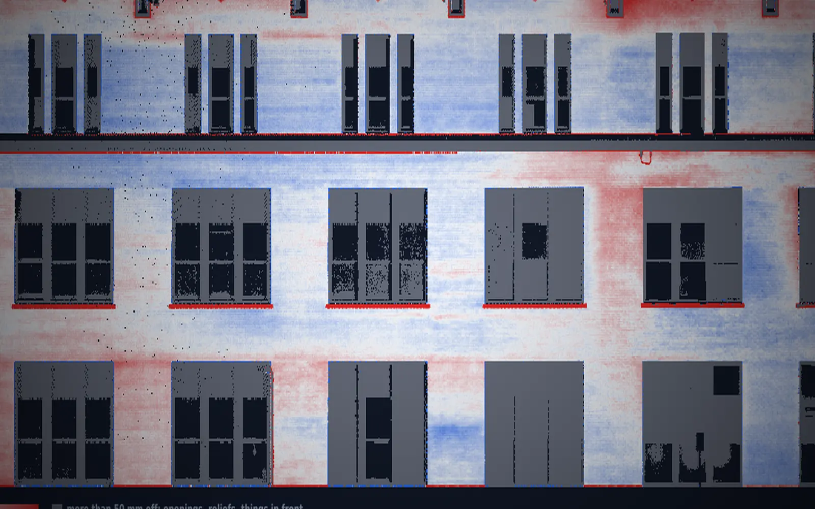
Heat map of a long facade from the AI scanning demo. Red stands proud of the wall's plane, blue sits back, and the windows are grey. In development

AI scanning demo

A replay of one building. A crew chose the stations, and the next spots were planned afterwards from each station's own points. Each answer says how much of the building is covered. When the points can't support a number, it says why. Run through the X9 bridge.

Rust · HTML · CSS

Aerial capture platforms

Two drone designs meant to work alongside the X9 scanner. A tripod scan covers what the scanner can see from the ground. The drones would cover roofs, canopy, open ground and tight interiors, and their photos would go through our photogrammetry pipeline (OpenDroneMap) to point clouds and orthophotos.

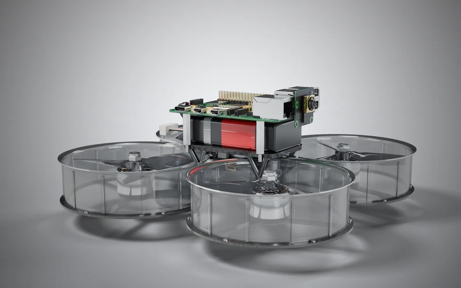
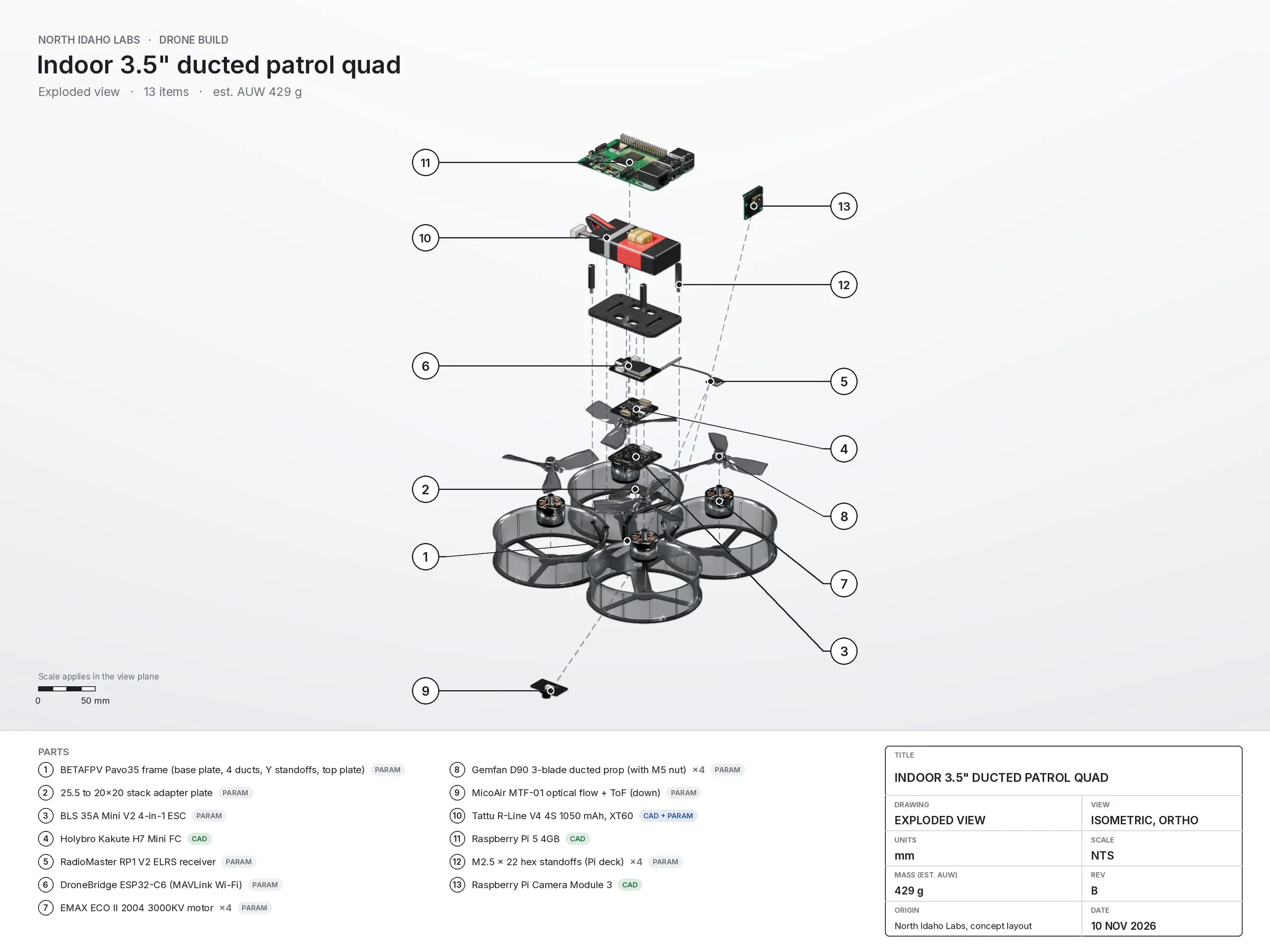
Rendering of the indoor ducted quad, with four clear prop ducts and a Raspberry Pi 5 and camera on top. In design

Indoor capture drone (3.5 inch ducted)

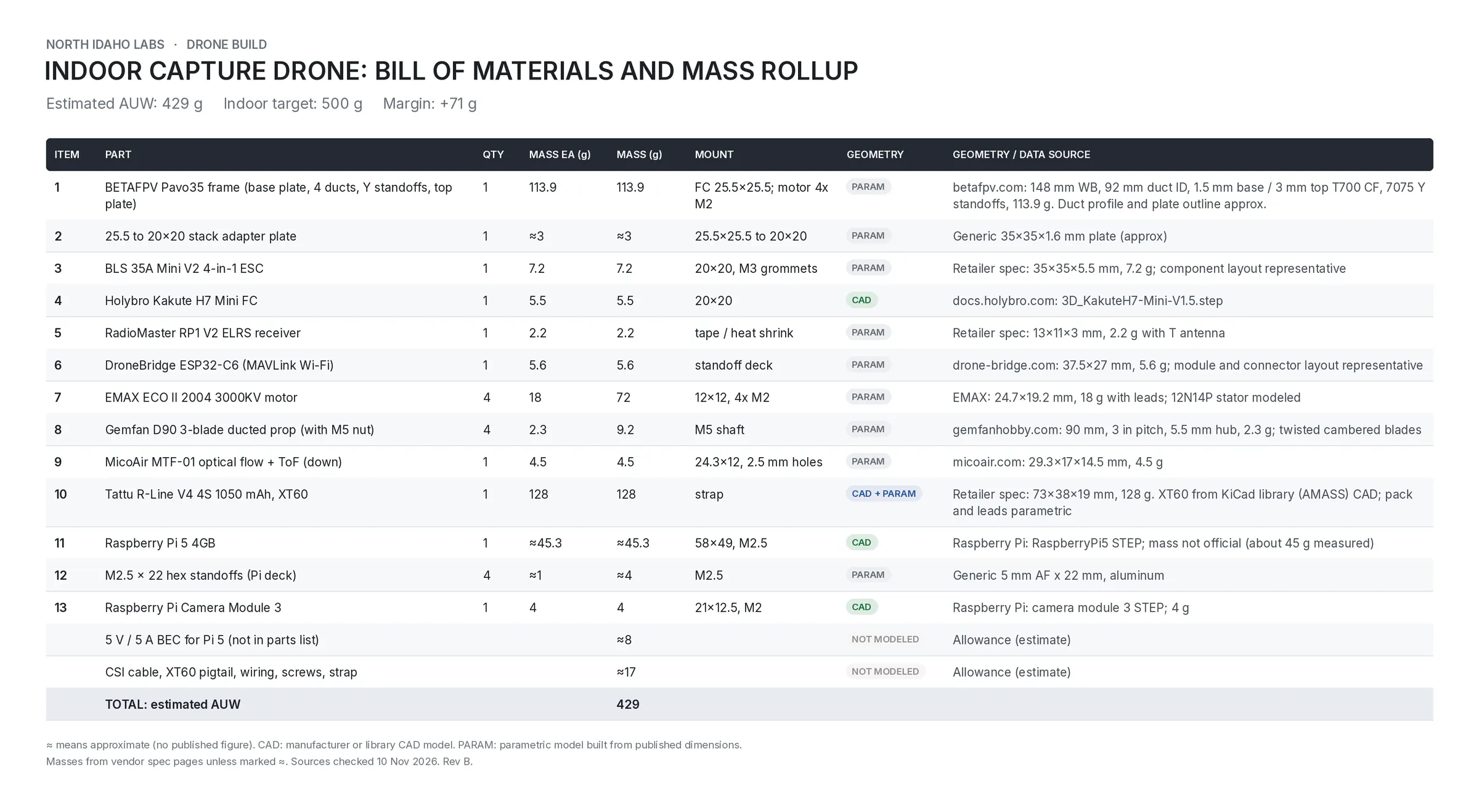
A small ducted quad for interior and structure capture: rooms, attics, crawl spaces and the undersides of decks, where GPS doesn't reach. It holds position with a downward optical flow and range sensor, and a Raspberry Pi 5 on board records photos from a Raspberry Pi Camera Module 3.

Frame
BETAFPV Pavo35, 148 mm wheelbase, four 90 mm ducted props
Flight controller
Holybro Kakute H7 Mini
Motors
EMAX ECO II 2004 3000KV (4)
Position hold
MicoAir MTF-01 optical flow and range sensor, facing down
Companion computer
Raspberry Pi 5 4GB
Camera
Raspberry Pi Camera Module 3
Battery
Tattu R-Line 4S 1050 mAh
Weight
about 430 g all up (estimated)

In the pipeline: close range photo sets of interiors and structure, processed to point clouds that fill the gaps a tripod scan leaves.

Python · CadQuery · Blender · PX4 or ArduPilot

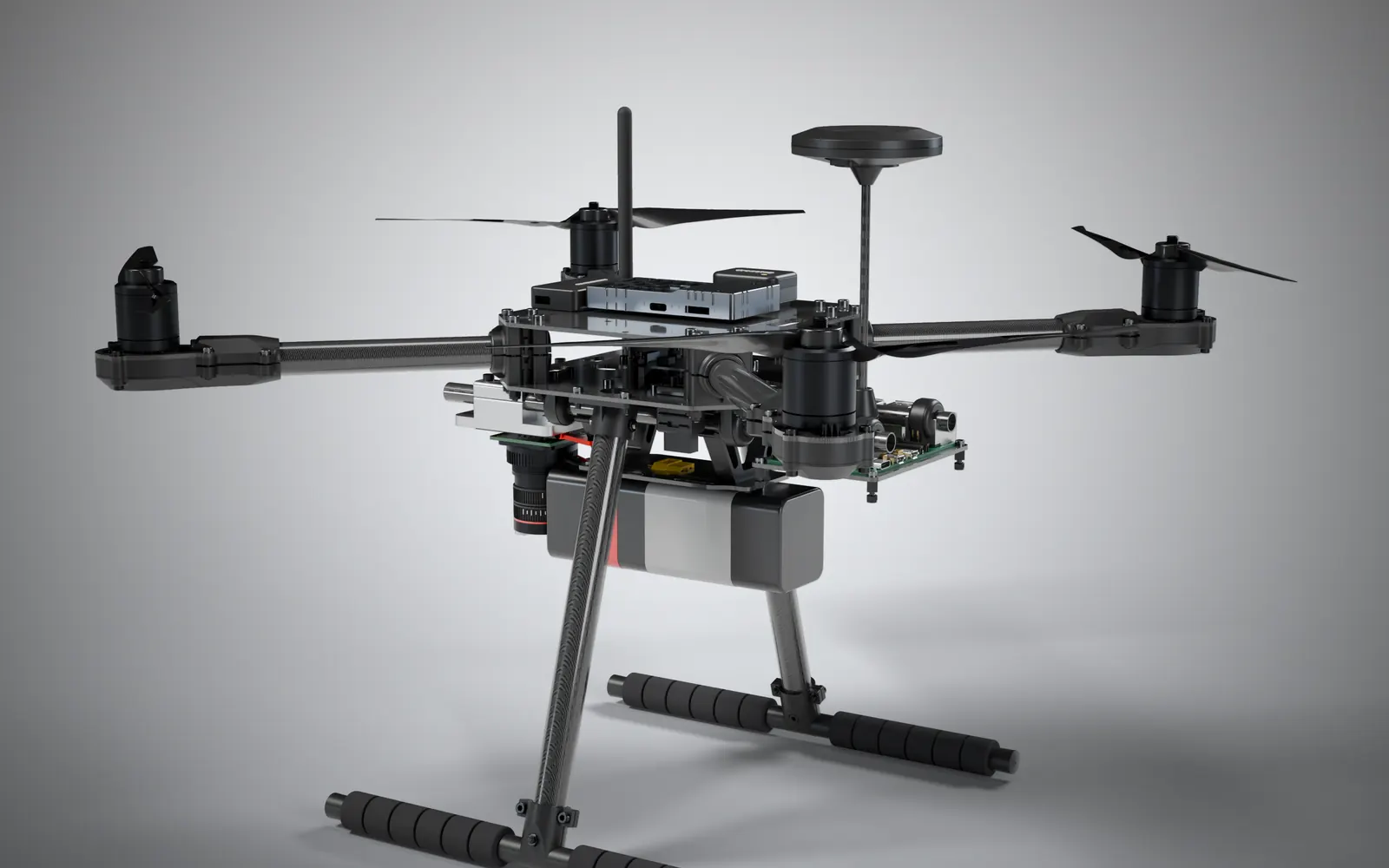
Rendering of the outdoor X500 V2 quad, with a GNSS mast on top and a camera pointing down. In design

Outdoor capture drone (10 inch, X500 V2)

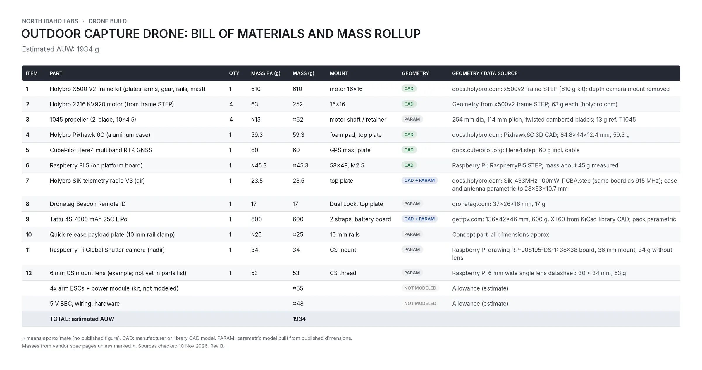
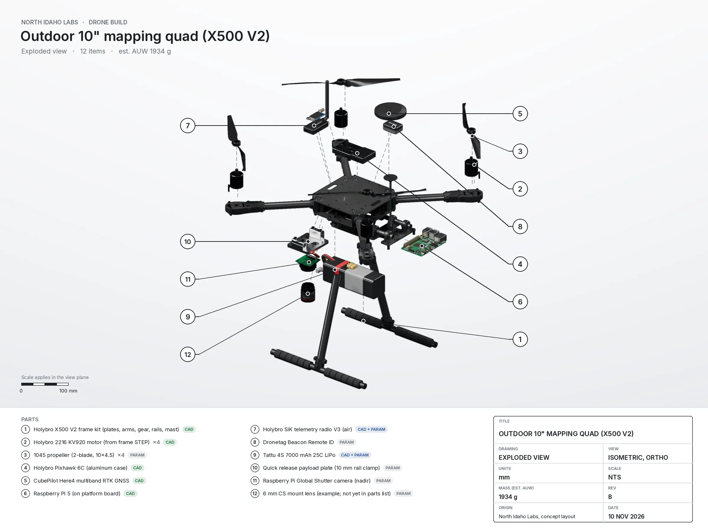
A larger quad for site and terrain capture: forest stands and field plots for NatureNet's ecology work, and construction sites from bare ground to as built. A global shutter camera points straight down, and a multiband RTK GNSS receiver tags where each photo was taken.

Frame
Holybro X500 V2 kit, 2216 KV920 motors, 10 x 4.5 inch props
Flight controller
Holybro Pixhawk 6C
GNSS
CubePilot Here4 multiband RTK
Companion computer
Raspberry Pi 5
Camera
Raspberry Pi Global Shutter camera, pointing down, with a 6 mm CS mount lens (example lens, not chosen yet)
Telemetry
Holybro SiK radio V3
Remote ID
Dronetag Beacon
Battery
Tattu 4S 7000 mAh
Weight
about 1,900 g all up (estimated)

In the pipeline: overlapping, geotagged photo grids processed to terrain and canopy point clouds and orthophotos.

Python · CadQuery · Blender · PX4 or ArduPilot

Weights are estimates. We added up published part weights plus an allowance for wiring and hardware, and we haven't weighed either drone.

The drawings are concept CAD. Parts with a maker's 3D model use it, and the rest are drawn from published dimensions.

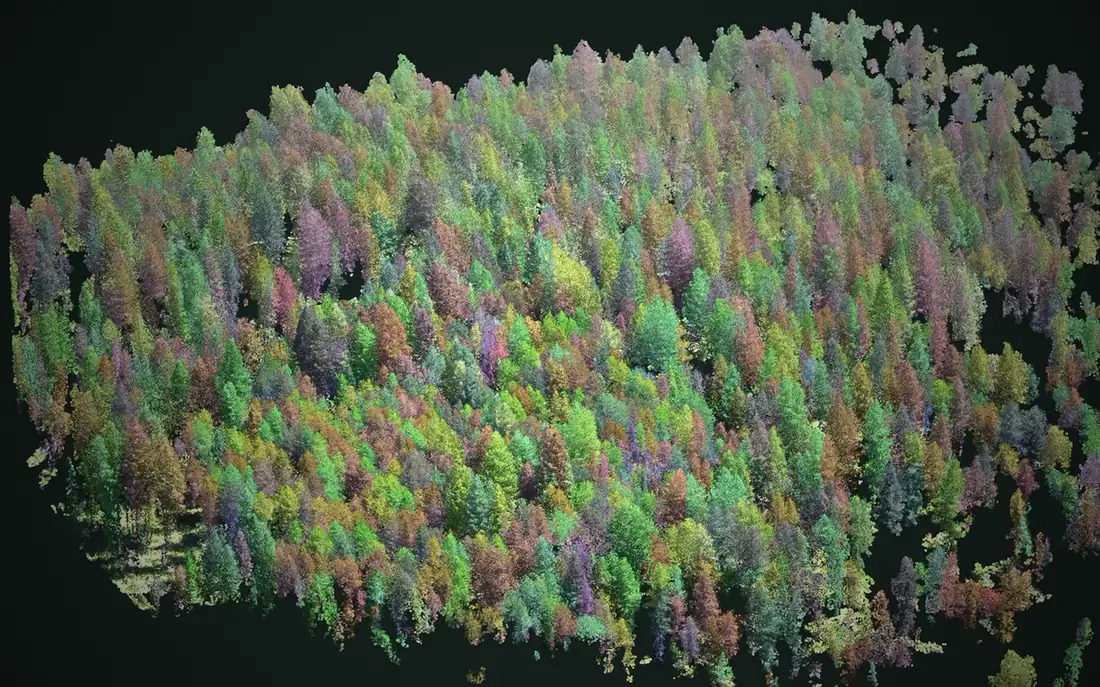
Aerial point cloud of a conifer stand from the NatureNet site, each tree drawn in its own color. Sister company

NatureNet

Sister company, still in development. Computer vision models (Detectron2 and RF-DETR) read aerial imagery to flag dead trees and invasive plants, and every flag goes to a review queue. From aerial video, the pipeline separates each tree with its own position, height and crown. As of Nov 10, 2026, naturenet.ai shows 495,000 image tiles processed and 17,600 pins in the review queue.

Python · PyTorch · Detectron2 · RF-DETR · OpenDroneMap · JavaScript

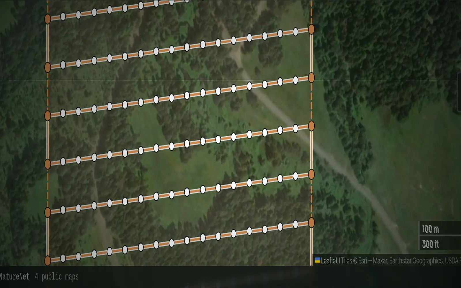
Flight lines and photo points drafted in the waypoint planner over a forest parcel. Live

Drone waypoint planner

A free web tool for planning drone flights. Draw the area you want covered in the browser, then download a KMZ a DJI drone can fly.

JavaScript · Python · Leaflet · AWS Lambda/S3/CloudFront

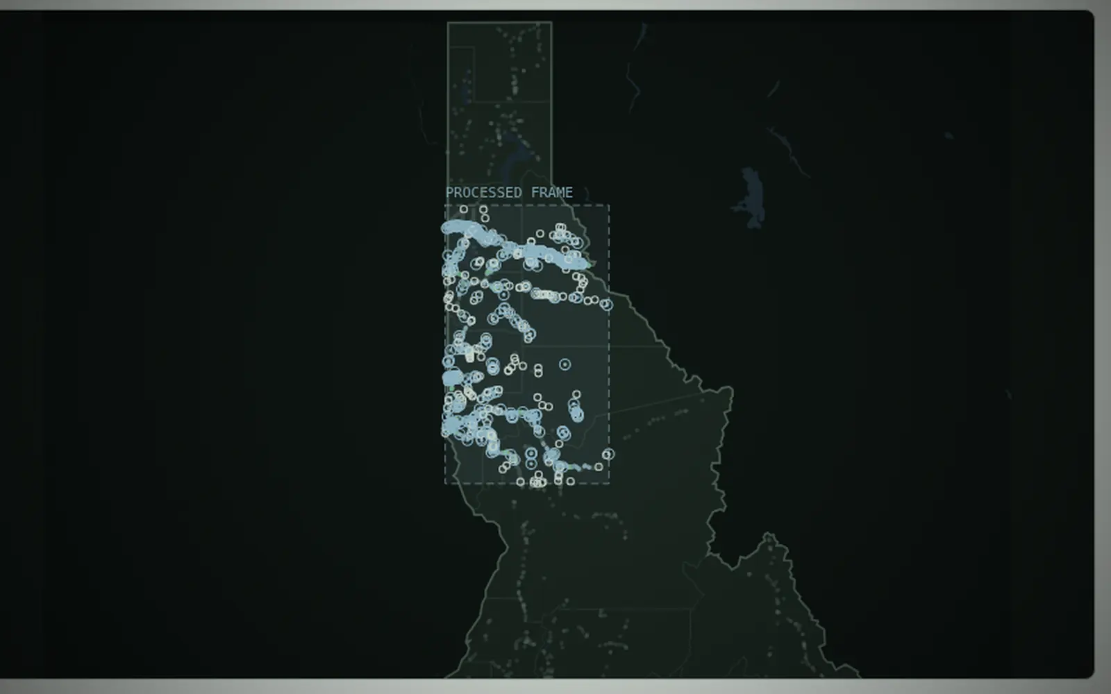
Map of Idaho from the Asset Atlas, with bridge markers in the area mapped so far. Live

Idaho Asset Atlas

Open maps of Idaho's state bridges and pavement, built from free public data, with the limits of the method published next to the results. We build the maps from those public records with a Python pipeline.

Python · JavaScript · S3/CloudFront

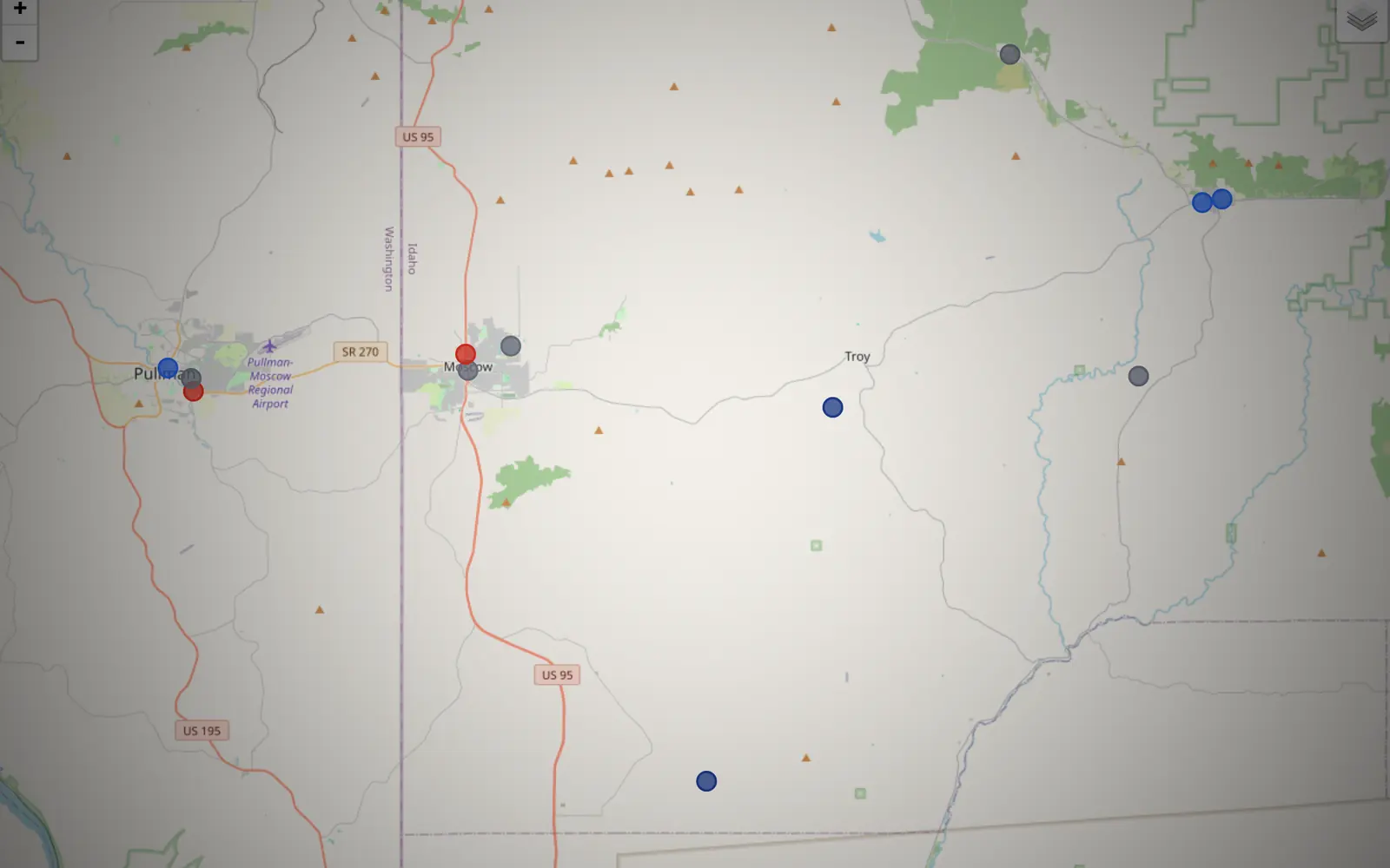
Map of the Moscow and Pullman area with colored markers for public-safety activity. Live

Latah County EMS activity

A map of fire, EMS and police activity heard on Latah County radio.

JavaScript · Leaflet · AWS Cognito · S3/CloudFront

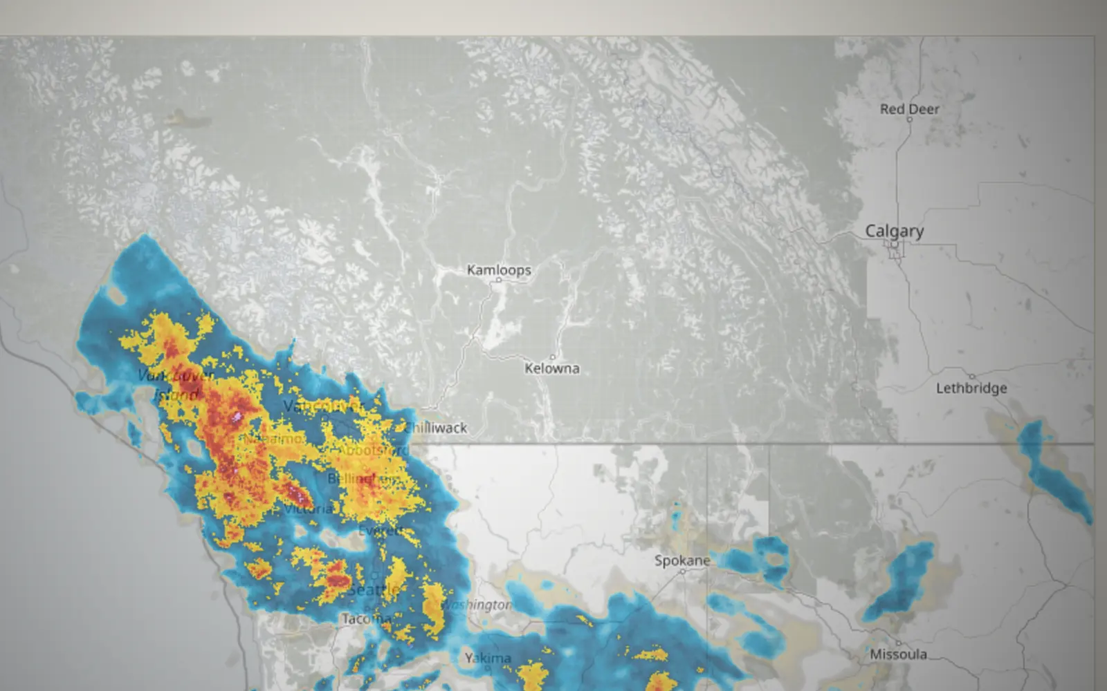
Precipitation radar from Latah Dispatch, with heavier rain along the Pacific coast and lighter rain inland. Live

Latah Dispatch

A local news site for Latah County, updated through the day.

HTML · JavaScript · Leaflet · S3/CloudFront

Archived
Line drawing of a bridge deck on two piers, in night green and copper. Archived

Local bridge look-ahead

A study of upcoming local bridge projects that was never published.

Python

Archived November 2026

Line drawing of a ridge and two pines, in night green and copper. Archived

North Idaho 3D Labs

The lab's 2024 site, under an earlier name.

HTML · CSS

Archived November 2026